3D Scans for Architecture, Engineering & Construction Industry
Capturing the Built Environment. Transforming Construction.
Streamline Every Stage of the Construction Lifecycle with Digital Twins Powered by LiDAR 3D Scanning Technology.
From pre-construction and existing conditions to progress tracking and final handover, our high-accuracy scans deliver reliable visual documentation — reducing risk, improving coordination, and enabling smarter project decisions.
Revolutionising the Built Environment
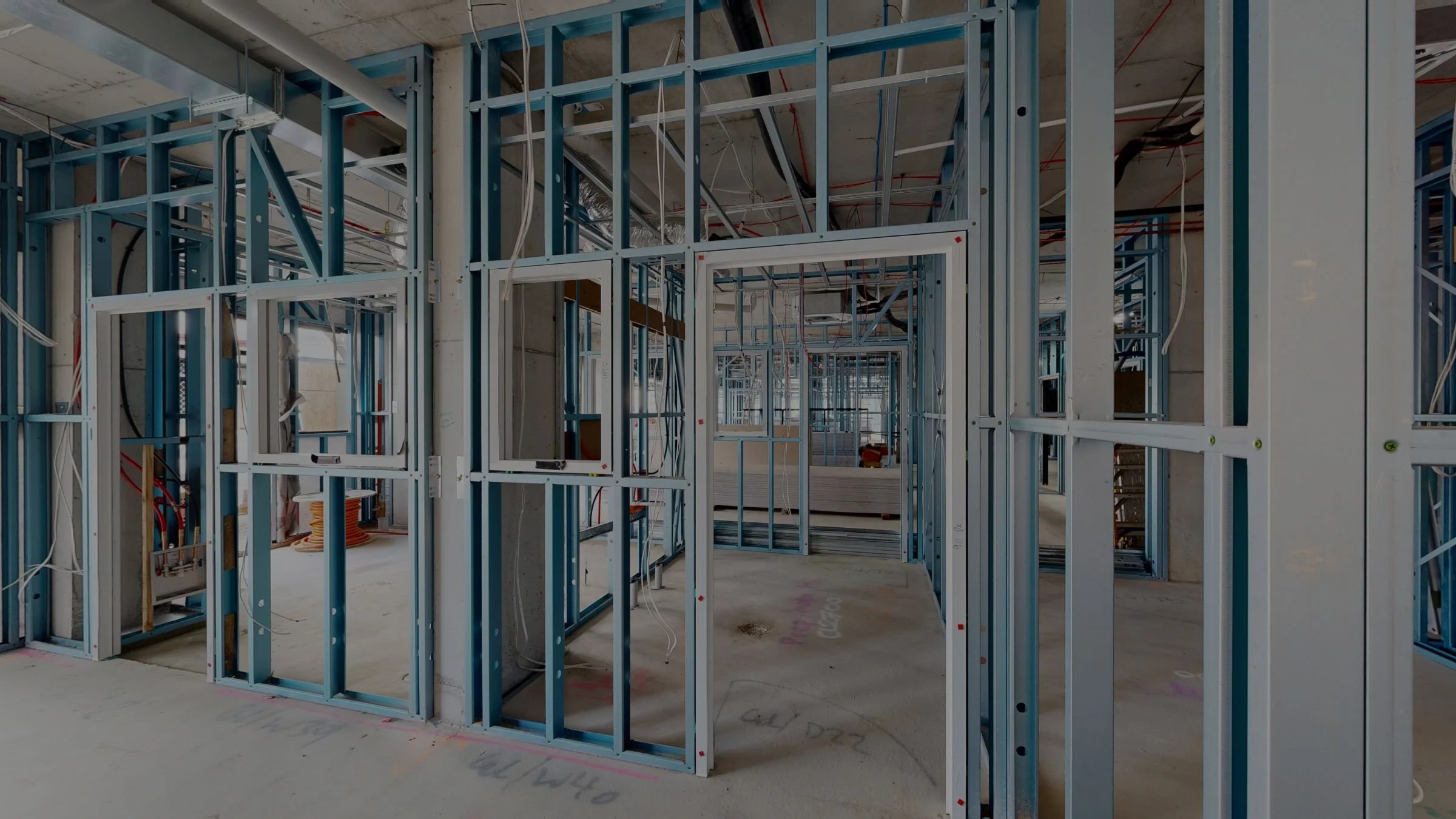
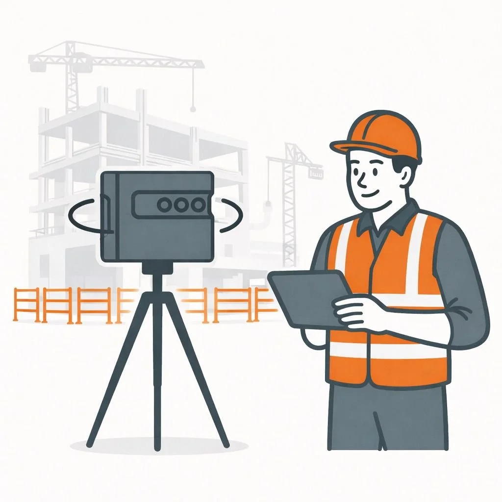
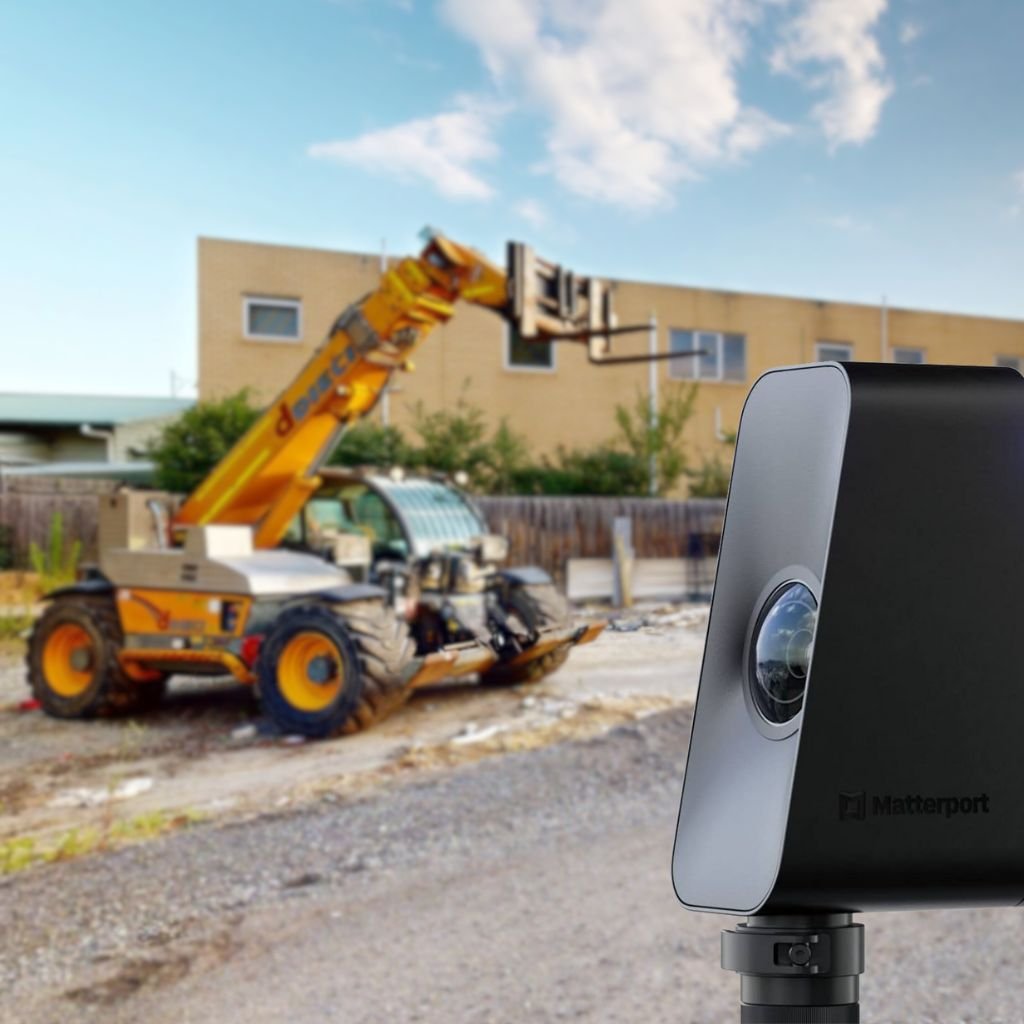
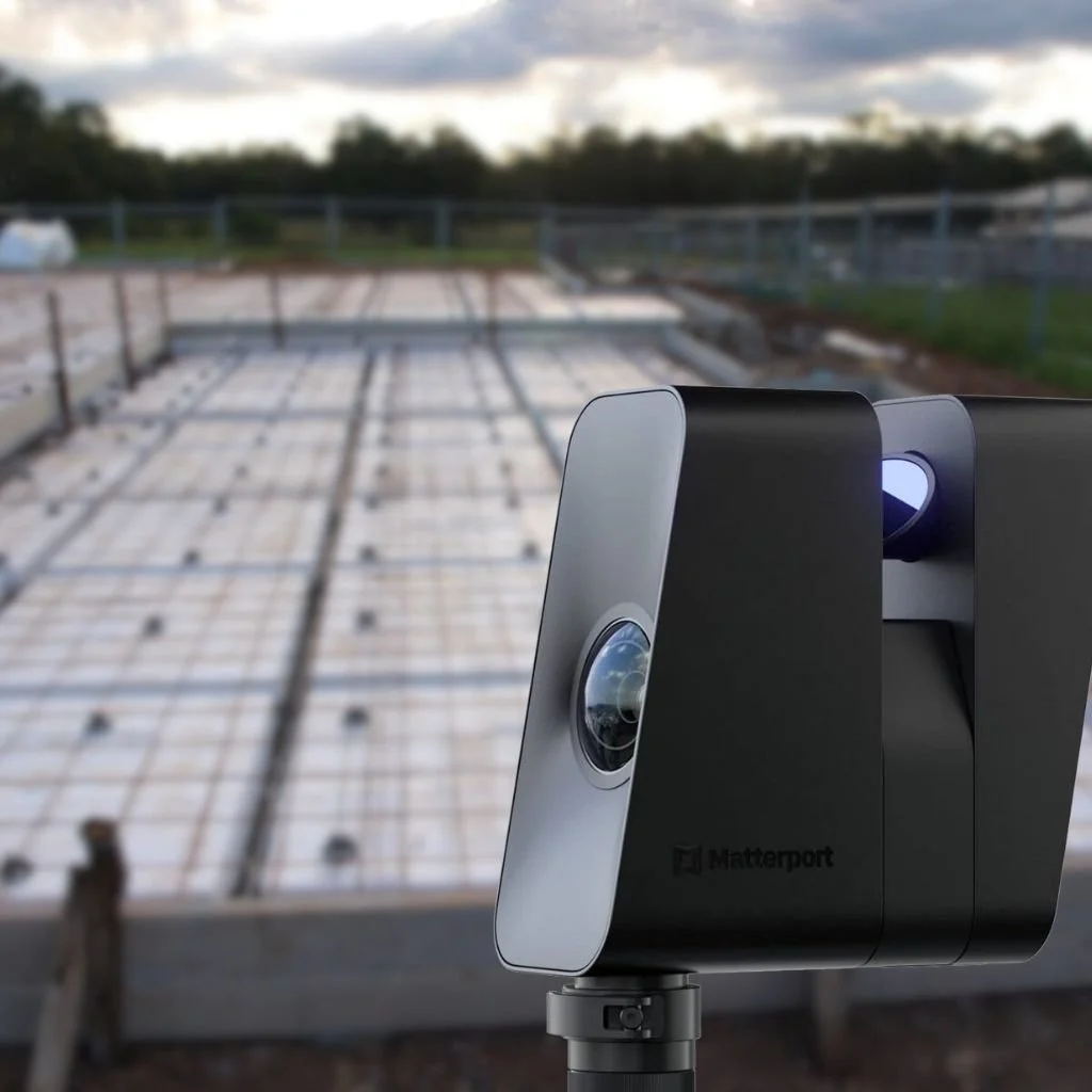
At Virtual Tour 360, we provide state-of-the-art 3D scanning services for the construction industry, utilising the latest Matterport Pro3 LiDAR camera. Our technology ensures precise documentation and data management throughout the entire project lifecycle, empowering stakeholders with unparalleled insights and accuracy.
Our Services
We specialise in delivering tailored 3D scanning solutions to meet the unique needs of the construction industry.
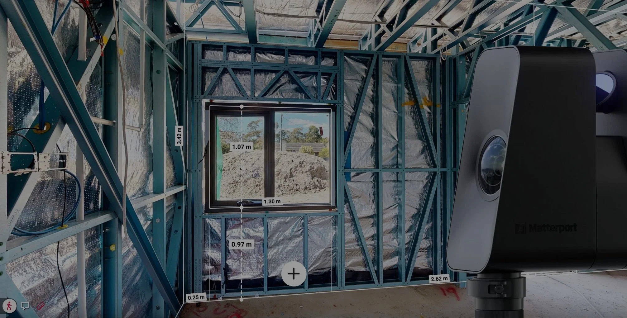
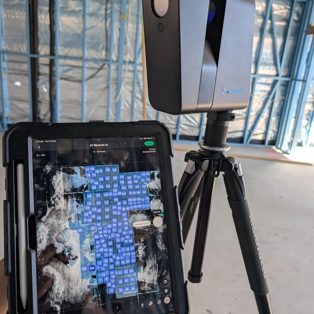
Powered by the Matterport Pro3 LiDAR camera, our technology captures precise measurements and spatial data for accurate as-built documentation and project coordination.
These 3D models enhance communication, save travel time, and provide clear visual records that can be referenced throughout the project. They also make it easier to collaborate with clients, ensuring better decision-making and increasing transparency. Matterport helps reduce errors, improve efficiency, and keep projects on track while showcasing the finished results.
From pre-construction documentation to final assessments, we support clients at every stage of the built environment lifecycle.
Turn Construction Sites into Actionable Digital Assets
Transform your buildings, sites, and projects into accurate, data-rich digital twins using Matterport Pro3 LiDAR scanning. VirtualTour360 captures the built environment in precise detail, creating a reliable digital record that supports planning, coordination, and decision-making at every stage of construction.
-
By maintaining a living digital copy of your site, teams can reduce rework, identify issues early, and collaborate remotely with confidence — saving time, minimising errors, and keeping projects on track.
Build smarter. Reduce risk. Deliver with confidence.
Bring clarity to your next construction project with LiDAR-powered digital twins.
Why Construction Teams Choose Digital Twins
Better Planning & Coordination: Capture existing site conditions in high resolution for design verification and risk assessment.
Remote Collaboration: Share interactive 3D models with contractors, architects, engineers, and clients — so everyone sees the same data.
Reduce Site Visits & Travel Costs: Review progress virtually, with precise visual records that minimise the need for frequent on-site inspections.
Improve Quality & Compliance: Use scan data to validate installations, streamline QA processes, and reduce costly rework.
Clear Documentation Throughout: Maintain an accurate, timestamped digital record from slab to finish.
BY THE NUMBERS
VirtualTour360 customers have seen:
75%
of project issues resolved without escalation
75%
decrease in in-person site visits from stakeholders
30%
cost/time savings with improved collaboration
70%
reduction in site survey costs and BIM file creation
Our Construction Services
We specialise in tailored 3D scanning solutions for every phase of construction, supporting stakeholders across the built environment.
Pre-Construction / Dilapidation 3D Models
Prepare your project with high-accuracy digital records of existing site conditions before construction begins. Using Matterport Pro3 LiDAR scanning, we create a true-to-scale 3D digital twin that captures surfaces, finishes, access points, and visible conditions — supporting planning, coordination, and risk mitigation across all stakeholders.
Benefits:
Document existing site conditions in high resolution
Support public safety, access, and site logistics planning
Measure clearances and site access with visual accuracy
Reduce disputes and unnecessary rework through reliable condition records
Existing Conditions 3D Models
Create an accurate record of a site’s current state before beginning or completing work. Existing Conditions 3D Models capture and document the existing condition of a site or building at a specific point in time, providing a clear visual record of completed works, outstanding items, and any existing conditions.
These models are particularly valuable when a project is handed over to a new builder, allowing incoming teams to clearly understand site conditions, reduce assumptions, and minimise disputes. They are widely used for risk management, insurance and dilapidation reference, and informed project decision-making throughout the construction lifecycle.
Benefits:
High-resolution documentation of current conditions
Accurate digital twin for works status
Efficiently share records with stakeholders and insurers
Reduce disputes during handover, recommencement, or rework
Pre-Slab 3D Models
Capture a detailed digital record of all in-slab components before concrete is poured. Pre-Slab 3D Models are crucial for documenting the exact placement of embedded services, reinforcement, and utilities — giving your team a reliable reference that reduces risk and avoids costly remedial work once the slab is cast. These models are suitable for all slab types, including ground slabs, conventional slabs, post-tensioned systems, and complex structural designs.
Benefits:
Accurately document in-slab elements prior to concrete placement
Prevent costly x-ray scanning and destructive investigation
Confidently cut and core concrete knowing key elements are identified
Enhance QA procedures with visual pre-pour records
Facilitate RFIs and live as-built review with clear documentation
Pre-Plaster 3D Models
Pre-Plaster 3D Models are captured after rough-in work is complete but before plaster lining or wall coverings are installed, providing a comprehensive digital record of framing, in-wall services, and structural elements. This accurate, true-to-scale model acts as a permanent reference that helps you understand what’s behind the walls before it’s hidden from view.
These models are invaluable for quality assurance, coordination, and risk management — letting builders, contractors, and project teams verify installations, identify discrepancies, and confirm compliance with design intent. By documenting all visible services and components before they are enclosed, you reduce the risk of costly rework, improve collaboration, and streamline decision-making throughout the build.
Benefits:
Validate in-wall and ceiling installations before they are covered
Strengthen QA procedures with visual pre-plaster records
Reduce costly rework by identifying issues before walls are closed up
Facilitate RFIs and compliance reviews with accurate as-built data
Defects / Final 3D Models
Defects / Final 3D Models provide a detailed digital record of outstanding work items and site conditions at key project milestones. Using high-accuracy LiDAR scanning, these models help you track and manage defects, document progress, and verify completion before handover.
They are especially valuable for tenant or client handover condition reporting, enabling clear visual reference of final finishes and outstanding items. This reliable digital documentation also supports maintenance planning, future construction amendments, insurance reviews, and protects against costly rework or disputes.
Benefits:
Track and manage defects with precision
Provide visual condition records to minimise costly reworks
Use as a handover condition report for tenants or owners
Support future project changes with a dependable reference
Why VirtualTour360?
We are experts in 3D scanning for construction documentation, delivering reliable data and exceptional service.
Tailored Solutions for Every Phase — From pre-construction through project completion.
Industry Proven Technology — Using Matterport Pro3 LiDAR for consistent results.
Precision & Efficiency — Accurate scans with quick turnaround.
Client Support & Collaboration — Helping teams make informed decisions throughout the build.
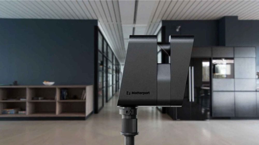
Why Matterport Pro3 LiDAR Technology?
Matterport Pro3 LiDAR technology delivers high-accuracy 3D scanning purpose-built for architecture, engineering, and construction workflows. By combining LiDAR depth capture with ultra-high-resolution imagery, we create true-to-scale digital twins that serve as reliable visual and spatial records throughout the entire construction lifecycle.
-
LiDAR technology captures spaces with millimeter-level precision, ensuring every detail is recorded.
-
The integrated LiDAR sensor captures up to 100,000 data points per second (Up to ~1.5 million data points per scan), generating dense point cloud data that is true to scale and accurate to millimetre-level precision.
-
Rapid scanning reduces on-site time without compromising quality. Each scan position can be captured in under 20 seconds, making site scanning quick and efficient, even on large projects.
-
Ideal for large sites and complex structures
-
Matterport Pro3’s LiDAR depth sensor performs reliably on typical built environments, producing high-quality visuals and depth data suitable for construction and asset documentation.
-
Produces vivid, high-resolution imagery for superior digital twins. Matterport Pro3 produces ultra-high quality 360° panoramic imagery (134.2-megapixel), giving you crystal-clear visual context of every space.
-
Export to industry standard formats for BIM, CAD, and project management workflows.
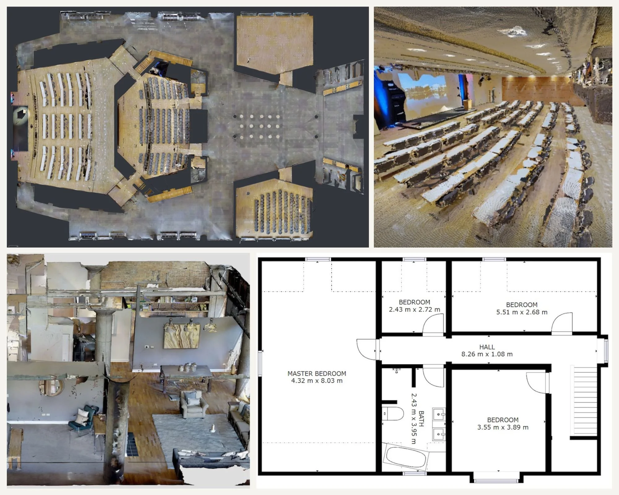
Powerful Deliverables from Every Scan
Beyond visual walkthroughs, Matterport Pro3 unlocks a range of professional-grade outputs that extend the value of every scan well beyond site capture.
-
Marketing-ready 2D floor plans generated directly from spatial data captured during scanning. These plans provide clear layout representation without manual measuring and are ideal for documentation, handover packages, and property records.
-
A comprehensive set of downloadable assets designed for architects, engineers, and construction teams, including:
Registered point cloud data
Floor plan and reflected ceiling plan images
High-resolution imagery
These assets can be imported into industry-standard software such as Revit, AutoCAD, ReCap, 3ds Max, and other third-party platforms. MatterPak™ enables faster as-built creation, design coordination, QA/QC workflows, and construction documentation.
-
The .E57 file is a vendor-neutral, high-density, colourised point cloud compatible with most 3D design and modelling software.
Matterport’s automated registration process, powered by Cortex AI, produces a fully aligned point cloud at scale — removing the need for manual registration and significantly reducing processing time.This allows Matterport Digital Twins to act as a single source of truth across collaborative design, construction, and asset management workflows.
-
Transform spatial data into accurate 2D CAD drawings (.DWG) suitable for documentation, verification, and integration into existing construction drawings.
-
Convert Matterport scans into LOD 200 BIM models delivered in .RVT and .DWG formats. These models support design coordination, refurbishment planning, and downstream BIM workflows with reliable spatial accuracy.
Built for Construction Confidence
Matterport Pro3 LiDAR technology gives construction teams fast, accurate, and repeatable site documentation — reducing site visits, improving coordination, and enabling smarter decisions from pre-construction through to final handover and beyond.
Get in touch.
Have questions or ready to explore how our virtual tours can transform your business? Fill out the form below, and one of our experts will get back to you shortly. Let’s bring your vision to life!